ProGeoOffice — software for GNSS data processing

About the program
A modern post-processing program that takes into account latest GNSS upgrades, latest capabilities of equipment for receiving satellite signals and online resources for necessary additional information, designed to process measurements performed for the purposes of topographic and cadastral surveys, geodesy, mine surveying and aerial photography. The program runs under Windows and Linux OS.
The program interface provides project management capabilities on the globe, which meets standards of the most popular GIS. Developers took into account many years of experience in the development of similar programs of their predecessors, i.e. Prizm, Pinnacle, Topcon Tools, Justin. The path from creating a project and importing source data into it to issuing reporting materials will not be difficult for any user. Advanced data management capabilities with graphs and tables will help an experienced user to perform processing and to achieve best possible results. The software takes full advantage of advanced technology products and is optimized to provide the highest post-processing accuracy with minimal desk processing effort.
A license key is required for the program to work. To get information on pricing and ordering, please fill out the application form
Documentation
The program documentation is available here
Entry number in the register of domestic software: 00000
Minimal system requirements
Operating system: 64-bit Windows, Linux
Processor: Intel, AMD (2 cores and more)
RAM: 8 GB and more
Free disk space: 500 MB and more
Program features and advantages
Coordinate transformations
External coordinate transformation plugin CoGeoPro includes more than 2600 coordinate transformations, 305 datums, 50 ellipsoids, more than 30 tasks of coordinate geometry. A module for calculating custom datums is provided.
Reports are generated based on user settings in various formats. It is also possible to select user's logo.
Possibilities
• Unlimited project size
• Supporting GLONASS, GPS, Galileo, BeiDou, QZSS, IRNSS
• Multi-threaded data processing
• Cartography on the globe
• Console version
Post-processing
• Static, kinematic mode
• Permanently expanding set of GNSS signals
• Precise positioning (PPP)
• Interactive data selection mode using a temporal graph (statics) and a vertical profile (kinematics)
• Automatic online access to Internet GNSS data sources
Adjustment
• Strict mathematical model – complete covariance matrices of solutions and reference points
• Free adjustment and adjustment on support
• XYZ and NEU gross error detection modes
• Networks up to 3000 points in size
GIS
• Cartography on the globe
• Online maps
• Support for layers and their properties – availability of object selection, visibility; selecting objects on a map using various tools; displaying data in the form of tables, graphs, charts; customizing styles and types of objects, including dynamic settings; setting up object labels; group data management; trajectories and vertical profiles
• Vector and raster background maps of popular formats
• Set of tools for working with map – translation, scaling, setting scale, selecting objects with cursor and in a frame
Export/Import
• Files including multiple bases and antennas
• Importing GNSS data – RINEX 2.11-4.0, compressed Hatanaka, RTCM 3.0, accurate ephemeris, NGS atx calibrations, P1C1 offsets, satellite clock
• Export RINEX 2.11-4.0 files
• Export into csv, shape, MID/MIF, kml, xml, PNEZD, StarNet, DXF, txt
Localization
• Export/import of project data
• 2D/3D mode
• Automatic and interactive methods for detecting gross errors
Aerial photography
• Import event files Ashtech.dat, Leica.ev, text template
• Event processing
• Database of aerial photography devices
Tools for working with GNSS raw data
• Thinning, changing intervals, merging, division
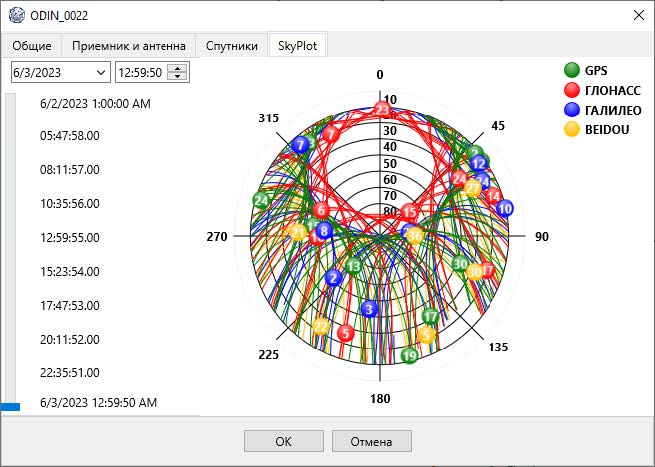
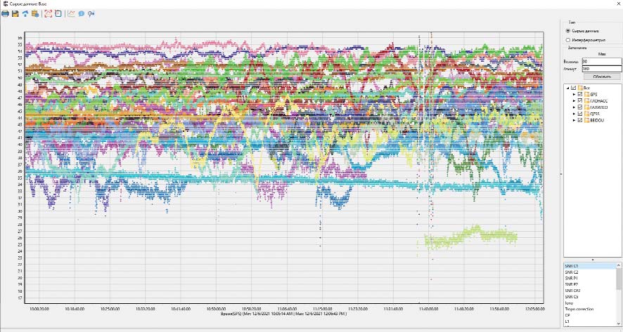
• Charts and tables of satellite signals
Additional information
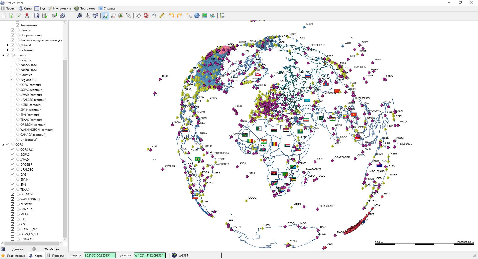
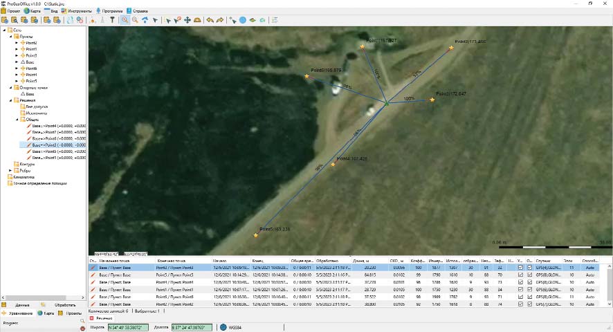
Distinctive feature of the PGO program is "cartography on the globe". The graphical interface contains necessary tools for navigating to objects used in the project when performing basic post-processing, adjustment and result analysis functions. Having minimal experience in working with geoinformation systems (GIS), a user can independently and in a short time process measurements and generate a report for submitting completed work.
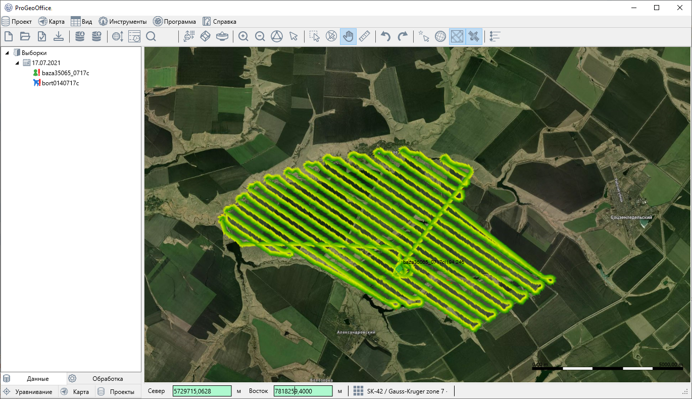
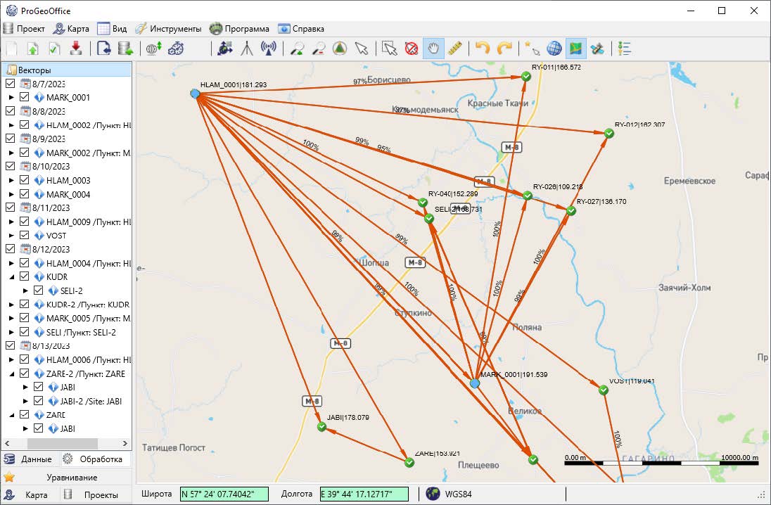
Cartographic window is a program element that allows one to perform both group and selective data processing. It displays objects and connections between them, and calls information tables and graphs. The cartographic window includes layers with controlled properties, namely visibility, color settings. Vector and raster maps are provided as layers. Using object signatures allows one to perform visual analysis of post-processing quality and adjustment results.
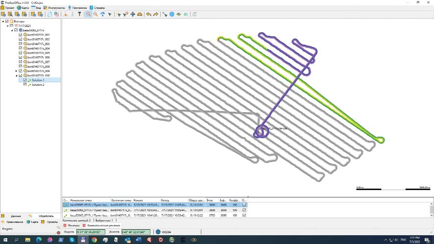
Bookmarks are not only informative. By using a table or a graph of a vertical profile one can exclude data from post-processing. As a selection criterion, navigation heights calculated in an epoch, PDOP, satellites are applied. Data selection is easy to be performed in tables using sorting, and on graph with a cursor or a special tool called rectangle selection. A cloud of navigation solutions allows one to distinguish epochs with poor-quality measuring information.
Main modules of the program
Import. Importing initial GNSS measurements files in RINEX formats versions 2.11-3.05, Hatanaka, archived files of certain formats, accurate ephemerides, antennae calibration results. There is a possibility of importing folder. In this case, the program automatically selects data from all files in the folder, checking them for duplication. This import method allows one to automatically form the correct configuration of constructions. New objects are created in the project panel, i.e. Samples, Receivers, Files, which are displayed in the "Data" tab. The structure provides correct import of files of multi-antenna receivers, as well as containing data from several base stations at once. An object tree may be sorted by date, name, size, and type. Cartographic window is filled with point objects, i.e. Points and Vectors, linear objects combining observations made simultaneously.
Topology of geometric constructions is ensured using the parameter "Tolerance for statics" set in project properties based on surveying points location density. Similar approach allows one to unambiguously formalize a criterion for a correspondence of map objects and real surveying points which is necessary for automation of data processing. A qualitative assessment of measurements can be performed based on initial measurements graph.
Post-processing. The recommended length of static Vector allowing to obtain solutions with measurement accuracy of 1-2 cm, is 300 km. The test post-processing of lines with the length of 3000-5000 km made with CORS network (USA), showed maximum discrepancies with a catalog of about 5-6 cm. To determine coordinates of points shifted to such a distance, it is proposed to use PPP (Precise Point Positioning) mode providing accuracy of 1-2 cm. Computing algorithms use both double and single differences in phase and code measurements, as well as Doppler data. Processing is performed in group or individual vectors. Using graphical interface, user has an opportunity to exclude some satellites and arbitrary observation intervals from processing, control processing modes, choose a tropospheric model. A large number of settings have a module for processing in kinematics mode which allows to take into account various modes of GNSS geodesic receiver movement most effectively.
Adjustment. Geodesic networks and trajectories of GNSS geodesic receiver are adjusted in a parametric way. Under the condition of closing contours, the accuracy of post-processing is assessed.
Final coordinates of points may be obtained when adjusting with reference points. First, it is recommended to adjust a free network in order to exclude inaccurate or gross solutions. To find inaccurate solutions, it is possible to choose an automatic or interactive mode. Free network is adjusted with generalized inverse of normal equations matrix. In addition to adjustment with assessment of residual in the geocentric coordinate system, it is possible to choose a topocentric coordinate system allowing one to identify specific errors in determining altitudes of antennae.
Events. The event processing module is designed for interpolation of coordinates by temporary marks. Some geodetic satellite receivers allow one to add (in hardware mode) a lens shutter operation temporal point of aerial photography device to a satellite data file. Information on moments of events is stored in a program database. The event processor contains maintenance tools for database with aerial photography devices: lens parameters, reduction of a camera projection center relative to a satellite antenna. Cubic splines are used to interpolate coordinates at arbitrary temporal points. Coordinates of events may be interpolated using both calculated and navigation solutions.
The dynamic change in color of point objects of trajectories depending on numerical statistical characteristics clearly reflects an accuracy of solutions within individual areas when processing data obtained in kinematic mode.
General functionality of the program is ensured by utilization of the following modules:
• Coordinate systems manager – selection of necessary coordinate systems from an external database of coordinate systems and and their import into a project, creation of new coordinate systems, datum calculation and localization. Batch processing of text files containing coordinates is supported;
• Reference points manager: creation of control points and their storage in a program database, exchange of reference points with a project;
• Antennae manager: selecting antennae from a standard list, creating antenna clones from a standard list with an ability to edit, manual creating of new antennae, importing files with antennae parameters in ANTEX and ANTINFO formats.
A layer of permanently working CORS and IGS base stations for downloading measurement files and coordinates for a project epoch allows one to calculate coordinates of points in the ITRF2008 and ITRF2014 coordinate systems in absence of reference points.
ProGeoOffice program may become a good alternative to similar developments by foreign companies that have left the Russian market since it is in no way inferior to software by Trimble, Leica, Topcon, and Javad.
Technical support is provided by experienced surveyors who are well versed in specifics of geodesic work in Russian Federation. There is also timely updating and actualization of the ProGeoOffice program when new GNSS appear or existing ones are modified.
 Русский
  English
